Scanifly touts the benefits of drones and aerial imagery
Solar Power World has dedicated its March 2024 coverage to installation tips for solar contractors big and small. You can read the rest of our Q&As in the magazine and online here.
For insight into the “installation aid” segment, SPW talked with Brad Knudsen, product marketing manager at Scanifly, about how drones and advanced aerial imagery have transformed residential solar design and installation.
How does using drones and aerial imagery help solar contractors in eventual hands-on installation?
Using photogrammetry-derived measurements from geotagged drone data ensures that final designs and engineering documents are perfectly accurate — no change orders or revisions will occur during the build process. Therefore, installers using plan sets based on Scanifly layouts are confident the array will always fit on install day.
More specifically, installers can access the Scanifly 3D model of the property on their mobile devices. This virtual replica helps conduct safety walk-throughs, get full site context and plan for the project before they arrive on site. Field teams can also refer to annotated images for any pertinent information from surveyors and designers, and as a result, installers save time, improve safety and are more prepared for each job. Installers can also compare preliminary designs to onsite designs side-by-side within Scanifly, giving them context for the final project.
Many installers must complete checklists for safety, site setup, inventory updates and job completion. Often, installers use a smartphone to take random photos, which can be disorganized, sporadic and miss crucial data. Using Scanifly’s mobile app and checklists, contractors can standardize and centralize all field data collection. Field teams can customize their checklists and mobile forms to adequately capture the dozens of data points needed to complete each project. Installers can annotate photos with solar-specific labels to add meaningful context for post-install audits and organize all media into albums for quick and easy review of the completed project.
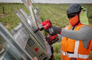
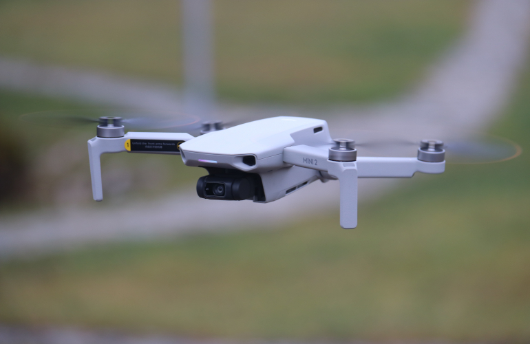
Why should installers have their own drone?
 Drones using RGB cameras (the standard environmental sensor for regular imagery and videos) allow installers to:
- Quickly examine the roof’s health and document any damaged areas before the installation begins to address them with the property owner and avoid being held liable.
- Easily confirm and record that the team follows all safety protocols with onsite drone images.
- Document installation progress and completion for marketing and promotional purposes without climbing back on the roof or scheduling an additional site visit.
Thermal drones with infrared cameras and sensors allow installers to detect hot spots and document system performance safely. A specific use-case is to confirm that a system has been operationalized and working sufficiently, especially on a new construction property that might not be fully electrified.
Some drones include both camera types, which can be a helpful combination for installers. And less expensive drones like the Mavic Mini can be used in most install-specific situations.
Having drones in-house also enables career development by creating opportunities to upskill employees and increase retention at the company. As a reminder, you only need one FAA-licensed pilot per crew. The lead installer is a good candidate for this.
How has design software evolved in the last few years, and what advances can we expect in the coming years?
3D modeling has gotten incredibly sophisticated. Designers can create highly detailed and accurate site representations, including surrounding structures, and run precise onsite shading analyses. We believe photogrammetry currently provides the best cost-benefit ratio for residential and commercial solar designs. Using photogrammetry-generated site replicas helps create designs that are perfectly accurate on install day, minimize roof time and are scalable.
 Incorporating LiDAR data has also led to more efficient, site-specific remote designs. However, an onsite shading analysis is often at least 30% more accurate than a remote shading analysis and should always be completed before finalizing a project. LiDAR is ideal when creating remote designs and preliminary production estimates in many locations, facilitating a more effective sales process. Regardless, designers should never only use remote data for final production figures. Fortunately, integrating remote LiDAR data into a drone-based 3D scene helps inform the shapes and sizes of dormant deciduous trees critical for accurate shade analysis — one of the many advantages of integrating multiple data sources for designing PV systems.
Efforts to design solar projects have gotten safer too. Virtual viewshed technology allows designers to automatically conduct whole-roof and per-module onsite shading analysis as accurately as a Solmetric SunEye without setting foot on the roof.
Thoughtful automation has drastically sped up the design process from preliminary layouts to permitting. AutoCAD exports of precise drone-based designs with square corners and perfectly placed panels enable the creation of stamped permit-ready plan sets within 48 hours.
Native mobile apps with customizable forms and checklists digitize field operations (survey, install, maintenance, etc.) and help centralize all project info in one place — merging field data with remote imagery, design data and engineering documents. PV design suites no longer just encompass the design process but operate within an end-to-end platform where data moves in real time across all project stages and users.
We’re looking forward to more advances in machine learning, AI and augmented reality. Expect algorithms to automate more of the design process. Solar design software will continue to improve its ability to auto-generate module layouts, identify stringing patterns and adjust for site- and energy-specific goals, vastly reducing manual design time. AR solutions would let designers visualize PV systems overlaid directly on the real-world environment through tablets or headsets. This could present huge advancements in site surveys and on-site/back-office collaboration.
This is all important because more precise site evaluations and intelligent automation translate to truly accurate onsite shading and production estimates without ever compromising safety. This more efficient process can reduce contractors’ insurance premiums and instill confidence in financial providers that production will be spot on. User-friendly tools and new AI solutions also make design capabilities available to a broader range of professionals, not just the most experienced engineers.